40 min
Overview
Honestly, this isn't the most scenic hike in the area. It does offer a pretty accessible, easy stroll, and a decent chance to see some wildlife. Most day hikers taking this stretch of the Pacific Crest Trail are ascending nearby Table Mountain or are thru-hikers just beginning (or ending!) the Washington State section of the PCT. Note that poison oak overhangs stretches of the PCT here, so learn to recognize it. The hike starts at the Bonneville Trailhead. You'll start up the Tamanous Trail. Ta-mah-no-ous is a Native American word translated roughly as "vision quest". Young men proved their readiness to be adults by going on a search for guardian spirits. From the parking lot, you start out on a gravel road but quickly divert up a wooded path that starts straight uphill. (Incidentally, if you continue down the gravel road another 100 yards, you'll see where the nearby train track enters a tunnel.) It won't be long before you have a nice viewpoint to the south overlooking the river just east of the Bonneville Dam. There won't be much more in the way of views until you get to the lake. It is somewhere in this trail section where the trail crosses over the top of the aforementioned tunnel...but you'll be hard-pressed to see where! After a little more than half a mile from the trailhead, you'll come to a junction with the Pacific Crest Trail. Turn left, and you'll be heading toward Canada (even if you are heading more west than north). There are two ponds near this junction, both unnamed - the first is seasonal and it may not be there during the warmer months; the other is farther up the trail just an 1/8 of a mile or so; look downhill and you'll see it between the trees. Follow the trail closely in this section, and do not divert onto the overgrown forest roads that intertwine here. In about a mile, you'll come to a clearcut as the trail turns sharply to the right. In fact, there are several clearcuts through the remainder of the hike, from different eras and in varying stages of regrowth. While they are an
Trail Stats
0.0 km
198 m
132 m
0 m
—
Photos

400px-GilletteLakeMap
400px-GilletteLakeMap

250px-PCTBonnevilleJunction
250px-PCTBonnevilleJunction

250px-TableErratic
250px-TableErratic

250px-HamiltonFromGillette
250px-HamiltonFromGillette
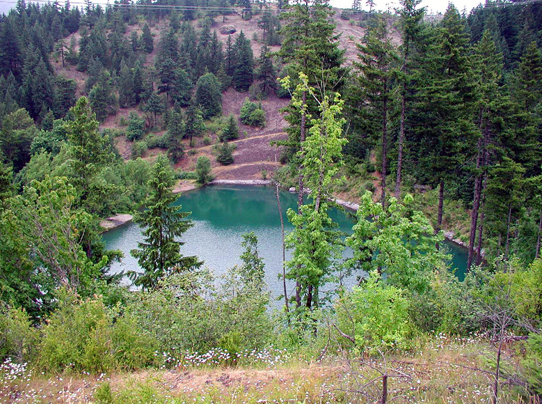
400px-GilletteLake
400px-GilletteLake