45 min
Overview
This trail was cut in the Summer of 2017 through a partnership between the USFS, TAMBA, and many volunteers. It follows the ridge line on top of a lateral moraine formed by a glacier and offers excellent views of Fallen Leaf Lake, Mt. Tallac, and Desolation Wilderness. <br><br>This trail is the first of a collection of trails being created in the Fallen Leaf/!Tahoe Mountain area that will eventually connect out to Angora Lakes and around much of Fallen Leaf Lake.<br><br>This trail rides well in both directions. It is very rocky and relatively flat, so even if you're riding "downhill" from Angora Ridge Road to Tahoe Mountain Road with a net elevation loss of about 575 ft., the rocky nature of the trail will keep you pedaling most of the way to maintain momentum. <br><br>Don't forget to take the time to visit the historic Angora Fire Lookout for an excellent lunch spot with sweeping views on either side of the ridge (turn right on Angora Ridge Road where the trail ends and ride up the road for about 50 yards).
Trail Stats
3.0 km
0 m
2213 m
2041 m
—
Photos
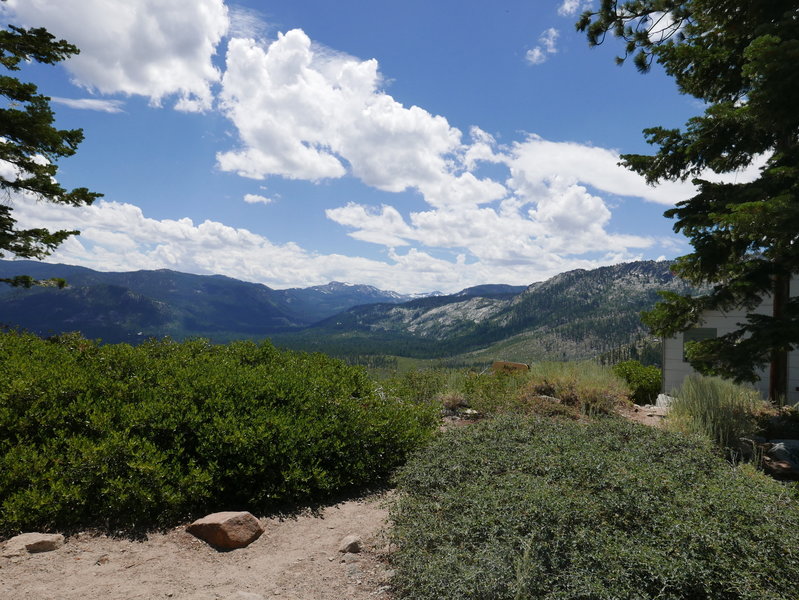
Top of Fallen leaf road
Top of Fallen leaf road
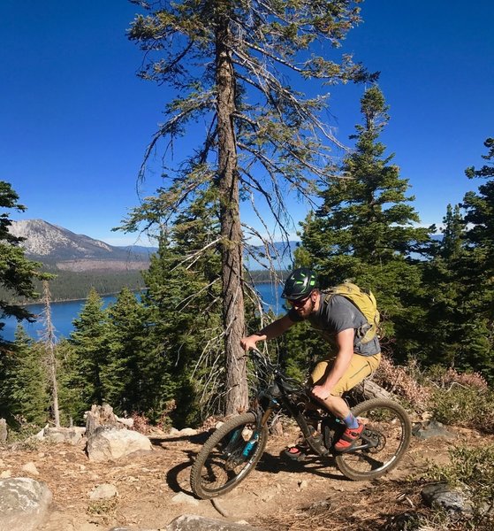
The Upper Angora Ridge Trail with Fallen Leaf Lake and Lake Tahoe in the background.
The Upper Angora Ridge Trail with Fallen Leaf Lake and Lake Tahoe in the background.