3.7 hr
Overview
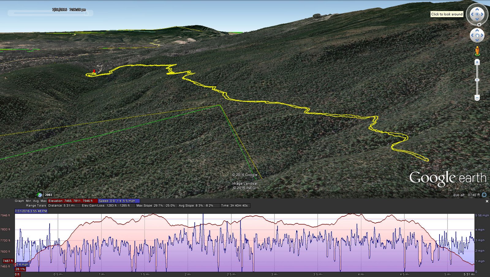
The Hike Elevation: 7,487 start, 7,933 maximum, 7,465 minimum Gross gain: 446 ft. Aggregate ascending 1,283 ft, descending: 1,283 ft Maximum slope: 30% ascending, 53% descending, 25% average Duration: 3:40 If you haven’t explored these hiking tracks with Google Earth, I urge you to try it. With the virtual 3-dimensional presentation, achieved by panning and tilting the
Trail Stats
8.6 km
1433 m
2402 m
2254 m
—
Photos
Trail photo
No caption provided.