1.3 hr
Overview
NOTE: Watch your speed; there's a drop off in places.<br><br>The Trail begins about 30 feet after leaving the paved Route 50. Look to your left for the Hawley trail sign, and don't be lured into continuing along the fireroad. It begins with very steep, loose switchbacks and 1 foot drops. The drops are rollable at slow speeds, or droppable at higher speeds. After about a 1/4 mile, the trail levels out to a smoother singletrack interrupted at times by loose rocky sections and nice views of the valley. After about a mile, there's a 30' creek crossing. During spring it's covered and you'll need to hike-a-bike unless you don't mind wet shoes (see photo taken in mid May). The trail continues with speedy singletrack and a few more loose rock sections where you must pick your line wisely. It ends with a sharp left turn onto a gravel, then paved road. <br><br>There are three choices at the end: <br>1. Connect to Route 89 and road ride back to town<br>2. Connect to Route 89 and road climb about 1.5 miles to the start of the Christmas Valley Trail<br>3. Connect immediately and climb Christmas Valley Trail, though I highly recommend taking the road climb and descending Christmas Valley Trail.
Trail Stats
3.1 km
261 m
2253 m
1991 m
—
Photos
Spring riding in South Lake Tahoe.. the snow melt overflowing the trail!
Spring riding in South Lake Tahoe.. the snow melt overflowing the trail!
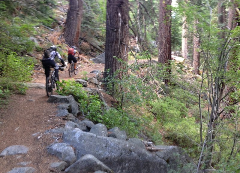
Mostly easy pedaling up.
Mostly easy pedaling up.
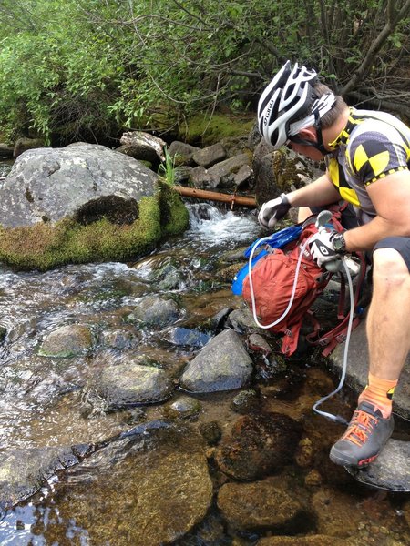
Filtering water from the Upper Truckee River before the next climb and final stretches
Filtering water from the Upper Truckee River before the next climb and final stretches
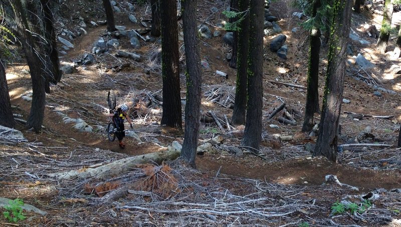
Top of Hawley Grade Trail... short hike-a-bike
Top of Hawley Grade Trail... short hike-a-bike
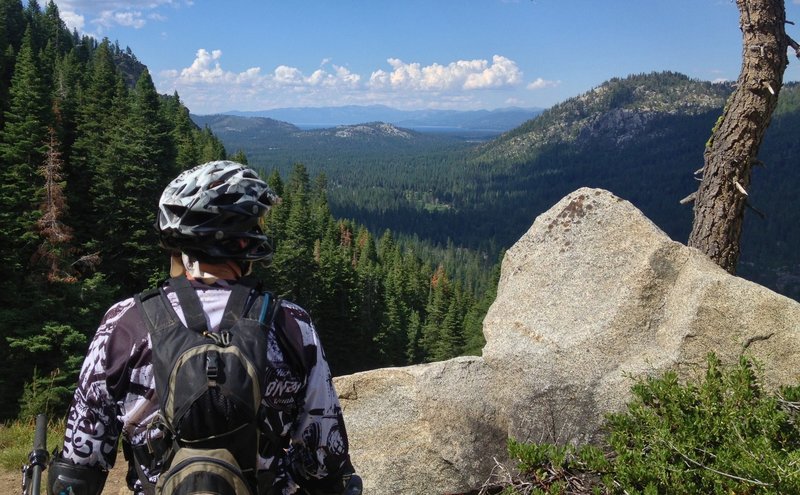
Last view of Lake Tahoe
Last view of Lake Tahoe
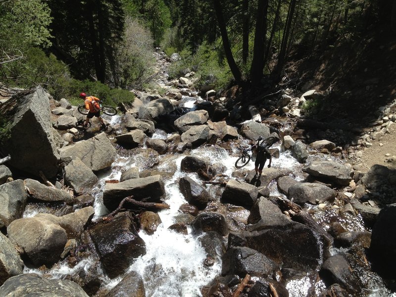
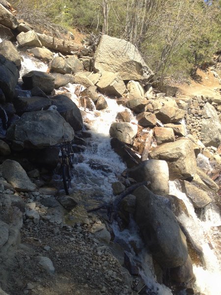
Crossing Hawley Falls when it is running pretty good.
Crossing Hawley Falls when it is running pretty good.
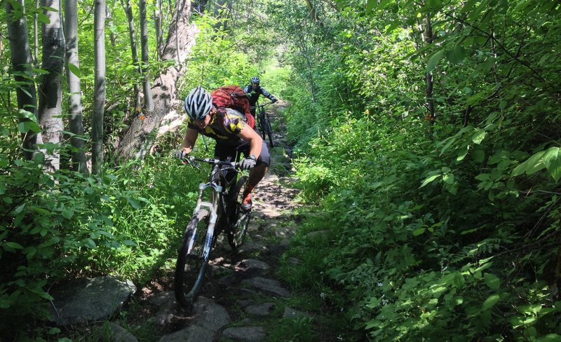
Climbing up Hawley Grade Trail.... green!
Climbing up Hawley Grade Trail.... green!