8.4 hr
Overview
Starting from Tahoe City, take the bike path north until you get to Village Road (look for a sign for the cross country ski area). Follow this road until it ends and look for a trail. There are many trails here, but it doesn't matter too much at this point, as long as you use the app and get on the right one eventually.<br><br>Find your way to Dollar Reservoir and have fun riding over the dam (or go around), and then follow dirt roads for a mile or two. This area is extremely confusing - did I mention you should use the app yet?<br><br>You now have two options:<br>Option 1. (shown here). Turn left on unmarked singletrack (named "Brutal connector to the TRT" here) and start heading up. The trail goes up and down a bit, but the middle section is a relentless 500' climb that most people will walk. The benefit of this option is you get up for some nice easy miles on the TRT. Follow the TRT for several miles of easy level, smooth riding on what must have been a road a long time ago. Arrive at 73 Rd and follow it for 100 feet before making an easy-to-miss left turn back on to singletrack. The next section is super fun, fast, bermed and buffed singletrack going slightly downhill. <br><br>Option 2. Continue on the dirt road for a while longer until you get to The Great Ski Race. Take this fantastic singletrack for a couple miles until it ends at Mt. Watson Rd. Take the paved road uphill until you find the TRT.<br><br>From either option, you are now at the Tahoe Rim Trail - Brockway Summit to Tahoe City where it hits Mt. Watson Rd. From here, the trail enters a beautiful forest with nice, relatively moderate switchbacks. These are fun for a while, but this last climb is surprisingly long and tiring. You'll wander around the Painted Rocks (with a few side trails available to explore), before heading out one more ridgeline.<br><br>When you find yourself in a huge pile of basalt (volcanic) rocks, you're finally finished climbing. Enjoy the views and now the fun really begins. You now have <b>ALMOST 6 MILES</b>
Trail Stats
29.6 km
597 m
2342 m
1910 m
—
Photos
Right behind the photo is a large meadow and a picnic table. Wound be a great spot to have lunch.
Right behind the photo is a large meadow and a picnic table. Wound be a great spot to have lunch.
View of the Truckee River from the trail
View of the Truckee River from the trail
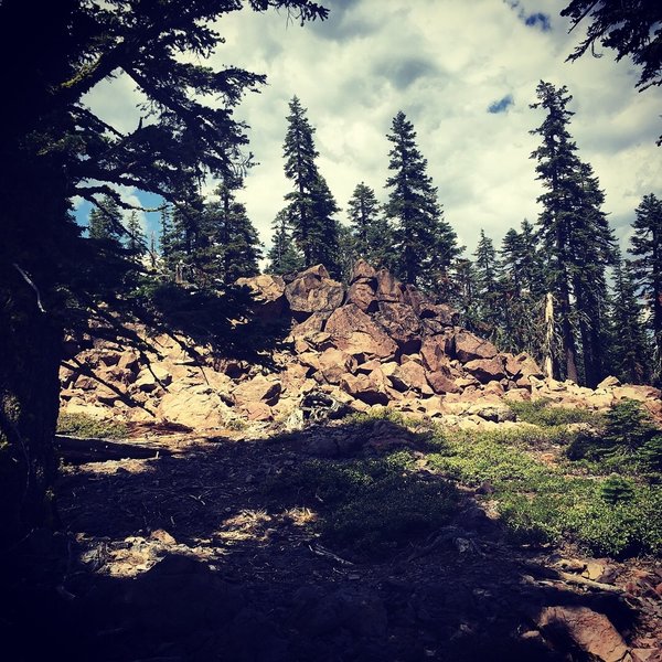
It gets rocky at the top.
It gets rocky at the top.
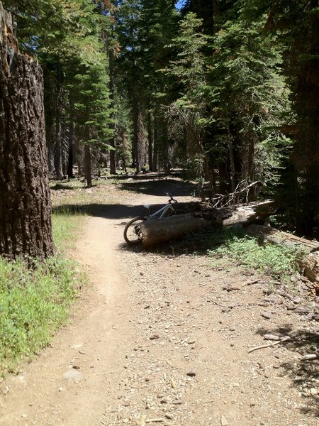
Nice woodsy section!
Nice woodsy section!
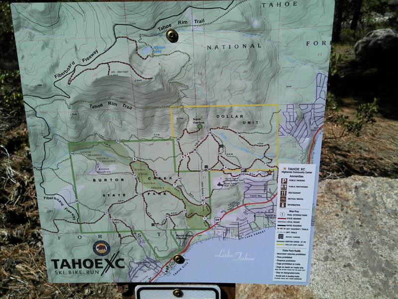
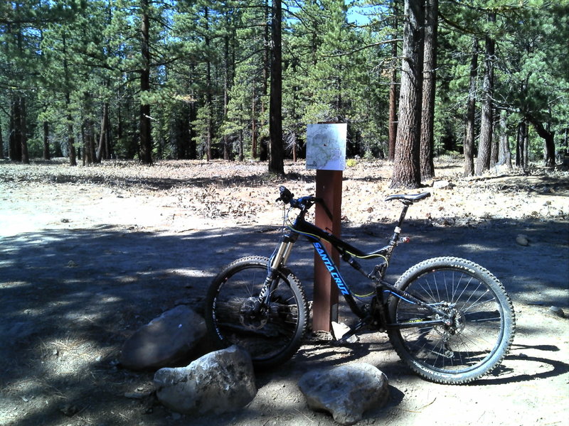
Some of the great signage and the trails to take beyond this one.
Some of the great signage and the trails to take beyond this one.
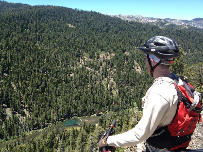
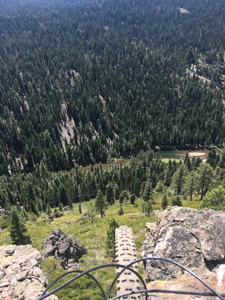
Looking down at the Truckee River
Looking down at the Truckee River
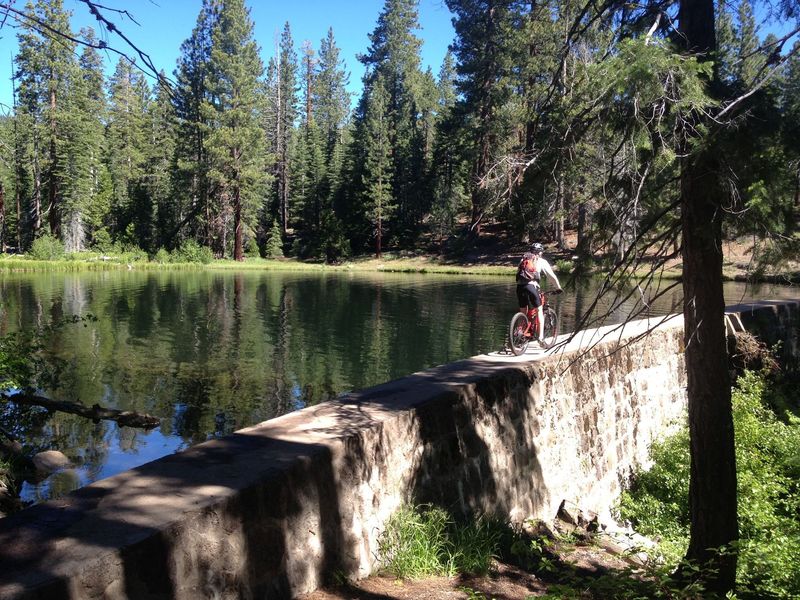
Over the dam on Dollar Resevoir - careful!
Over the dam on Dollar Resevoir - careful!
Do you see the Old Lady?
Do you see the Old Lady?
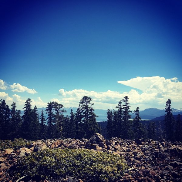
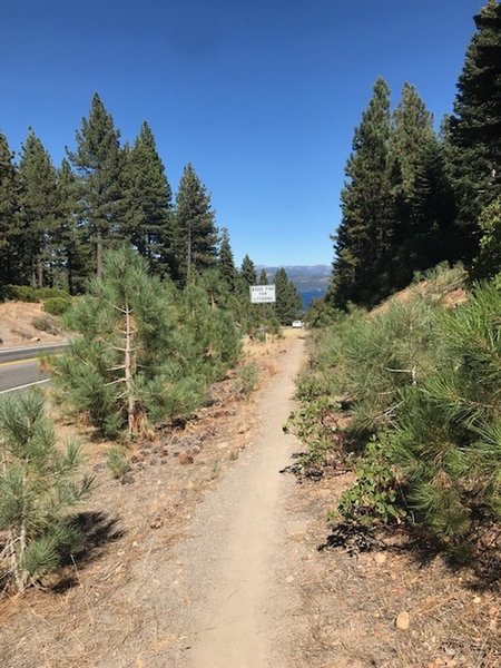
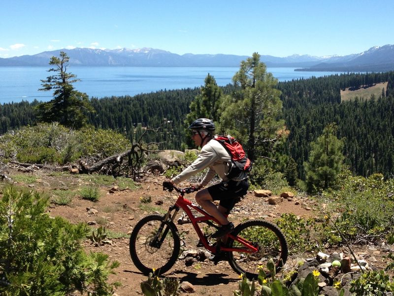
Beautiful View of Lake Tahoe from the Trail
Beautiful View of Lake Tahoe from the Trail
Scenic ride around Lake Tahoe via Dollar Point Trail
Scenic ride around Lake Tahoe via Dollar Point Trail
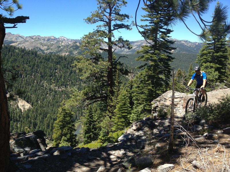
Careful riding along "Thunder Cliff" above the Truckee River
Careful riding along "Thunder Cliff" above the Truckee River
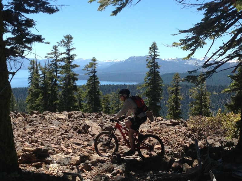
The high point of this ride, and a damn fine place for a rest.
The high point of this ride, and a damn fine place for a rest.
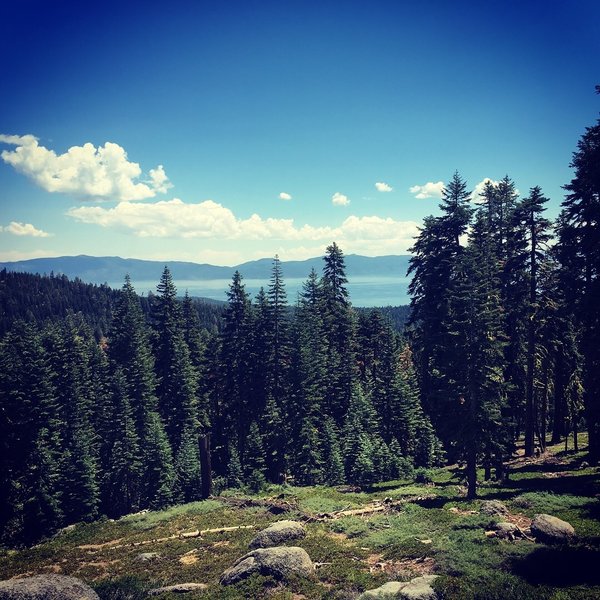
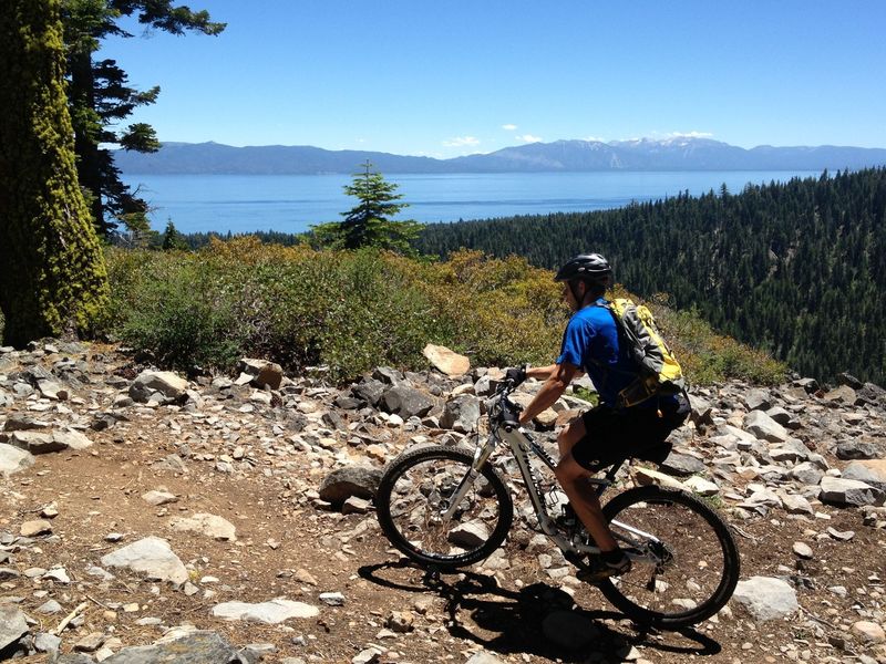
These views don't get old!
These views don't get old!
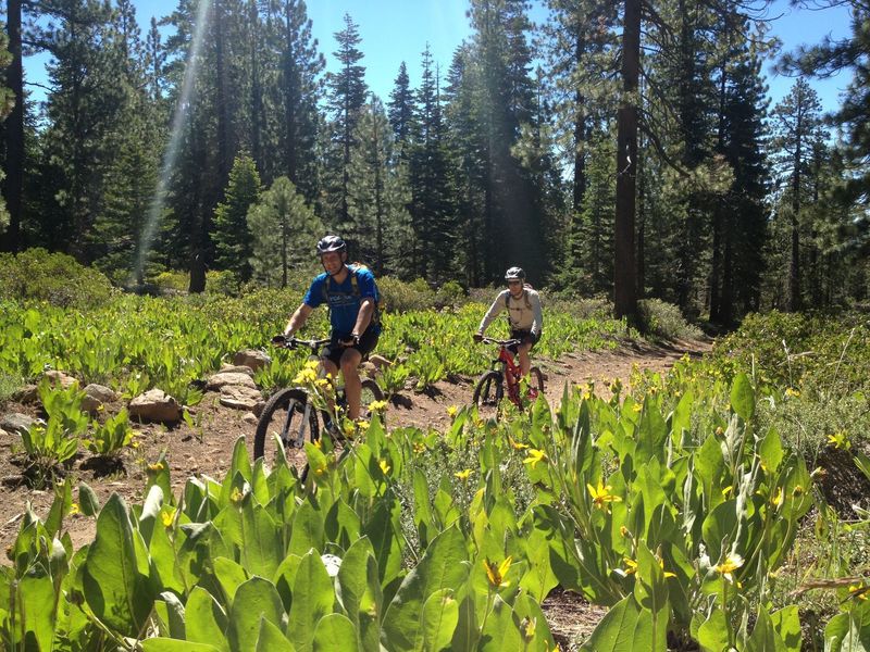
June flowers on our way up to the Tahoe Rim Trail
June flowers on our way up to the Tahoe Rim Trail
Yep, just another view...
Yep, just another view...