3.5 hr
Overview
The Clementine Climb trailhead is just across the bridge from the ranger hut on Old Foresthill Rd or the left hand side. There are pit toilets, a ranger station, and posted maps. The rangers are super helpful if its your first time out or just want some inside trail scoop. It does cost $10 to park anywhere along the road in this area, which they enforce. The ranger takes cash, but can make change for you. This is a popular area, so parking fills up pretty fast on weekends.<br><br>The Clementine Climb (i.e. fire road) starts off flat for few 100 yards, then starts climbing. It's a good steady, but manageable, climb up the dirt fire road for about 2 miles total. It'll definitely get you warmed up and breathing hard though. You'll hit a the paved "Lake Clementine Rd" at roughly mile 2 (keep following the road going up the hill at the fork), where you'll continue your climb on this paved road for about 1.4 miles. The paved road is a bit steeper than the dirt fire road, but still manageable. <br><br>At ~1.4 miles you'll see the trailhead on the right hand side for Fuel Break Trail. There's parking and porta pottys at the trailhead. Take the Fuel Break Trail for about ~0.5 miles then veer to the left to catch the Culvert Trail.<br><br>Culvert Trail is a fast, flowing downhill singletrack trail, with most of the corners bermed. This trail is a lot of fun! Not a lot of rocks or roots, just flowing fun. Culvert Trail is ~1.2 miles in length, and about halfway you cross through the actual "culvert" (i.e. big pipe going under Foresthill Rd). You'll lose your vision a bit due the darkness at first, but just stay straight and calm and you'll be fine. The pipe is relatively smooth without any obstacles. <br><br>Culvert Trail ends at Old Auburn Foresthill Road. Cross the street and head down Mammoth Bar OHV Access Road to catch the start of the Confluence Trail, which is a few 100yds down the road on the right hand side. This is a fast singletrack that will take you back to the start of the Clementine Climb. This singletrack i
Trail Stats
11.9 km
333 m
497 m
178 m
—
Photos
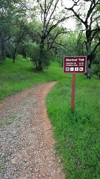
Start of the Shortcut Trail at the junction with the Fire Break Trail.
Start of the Shortcut Trail at the junction with the Fire Break Trail.
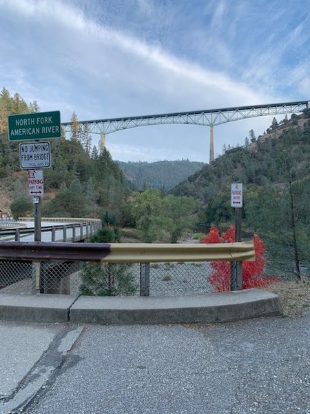
At the Clementine Climb Trailhead
At the Clementine Climb Trailhead
Confluence
Confluence
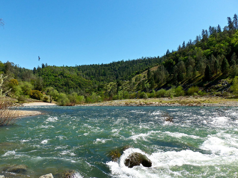
Lake Clementine downstream
Lake Clementine downstream