10.5 hr
Overview
Park at the first significant gravel pull-off past Habegger Road (31E305). Habegger Road access is actually labeled Miller, for the owner of the home past the gate. A short section of gravel road going down and north out of that pull-off will take you to Habegger Road (31E305) where must go around a gate before you start your first and biggest climb. The road starts out as singletrack, but eventually becomes more of a road as you climb. Stay left at intersections, continuing on the main road to go up and across the ridge, and make a fast descent down into meadows. <br><br>The three-way intersection is hard to miss. Make a right onto Coyote Ridge Road and start climbing again. This climb is steeper, and takes you higher as you cross up and over Coyote Ridge. Go through a small dip, climb back up again, before enjoying a steep, loose descent back down into the trees. The climb back up from here is the worst, and will certainly require some pushing. Eventually, you'll top out at 11,700 feet, and descend down to a view of Green Lake. <br><br>From here, carry your bike across the trail-less area southeast along the escarpment for 0.3 miles before you reach Green Lake Trail. Turn right, and descend (don't head the other direction as this crosses into a Wilderness Area).<br><br>The first section of trail is a narrow side-cut along steep talus with extremely tight switchbacks, and a few inconveniently placed rocks that threaten to toss you down to Green Lake. <br><br>At Green Lake, cross a stream, and ride some techy bits along the edge, make a little up, and continue on. From here, the trail changes between technical rocky sections, and more mellow, sometimes wet, meadow riding past Brown Lake on your left, then Bluff Lake on your right. <br><br>Unsurprisingly, after Bluff Lake, things get steep again. The trail drops into a long series of switchbacks with tight, technical rock chutes and steps all the way down to Parchers Trail (31E04) where you make a right. <br><br>Don't expect it to get easy yet. While it's a bit l
Trail Stats
32.7 km
1402 m
3564 m
2562 m
—
Photos
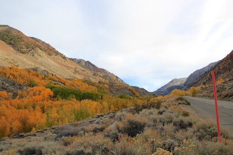
Bright colors don't get any better.
Bright colors don't get any better.
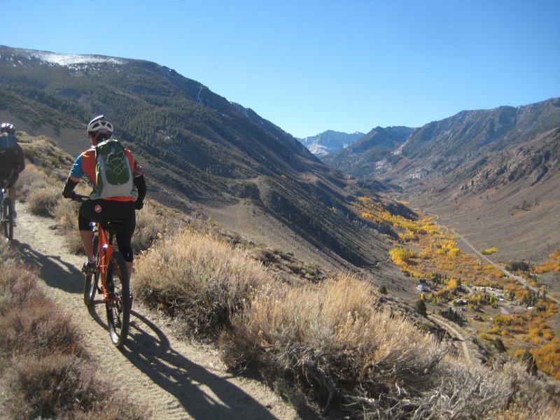
Habeggers Climb above the fall colors.
Habeggers Climb above the fall colors.
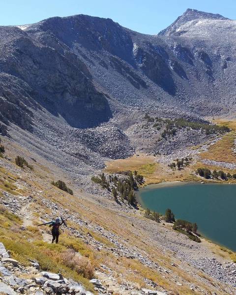
What going up Green Lake Trail looks like.
What going up Green Lake Trail looks like.