5.0 hr
Overview
The Chimney ride is a mostly fire road climb to Brandy Creek Falls and then a linking of singletrack trails and some fire road back to the trailhead.<br><br>Directions:<br>Park at the Brandy Creek Trail trailhead. There is a small parking lot at the trailhead on the south side of JFK Memorial Drive and a larger one on the north side with a restroom and water.<br><br>Start the ride by climbing Shasta Bally Road, stay straight at the first intersection, following the signs to Sheep Camp/Shasta Bally (left is Peltier Valley road, right is Brandy Creek Campground).<br><br>Keep climbing on the Shasta Bally fire road, you'll pass several signs for Brandy Creek Trail on the right, just keep going up the road.<br><br>At the next major fire road fork stay left towards Brandy Creek Falls.<br><br>You'll pass trailhead signs for Salt Gulch Trail and Rich Gulch Trail on your left and another Brandy Creek Trail sign on your right. Just keep climbing up the fire road.<br><br>The fire road climb ends at the Brandy Creek Falls trailhead. There is a composting toilet restroom at the trailhead.<br><br>Keep climbing up the Brandy Creek Falls Trail. The trail is wide but very steep in some sections. All rideable. <br><br>The Brandy Creek Falls Trail connects to the Rich Gulch Trail which will be on your left as you climb to the waterfall. You can either turn left directly onto Rich Gulch Trail, or you can keep climbing to the waterfall (which is what we did) and then backtrack to Rich Gulch Trail.<br><br>The first part of Rich Gulch Trail is very steep and loose, but quickly turns into a great downhill with some fun burms and jumps. There are no turns off of Rich Gulch Trail, just take it all the way down, back to the fire road.<br><br>When you hit the fire road, turn left and go back up the fire road to the Brandy Creek Trail sign on your right. This time, drop onto the Brandy Creek Trail. It's singletrack down to the Sheep Camp bridge. <br><br>When you hit the Shasta Bally road again, turn right (don't cross the bridge) and climb
Trail Stats
16.2 km
567 m
811 m
397 m
—
Photos
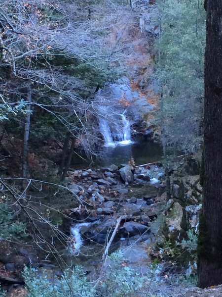
Brandy Creek Falls. December, 2013
Brandy Creek Falls. December, 2013
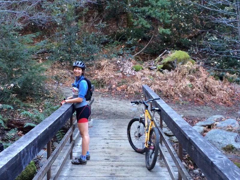
Creek crossing footbridge on Brandy Creek Falls Trail. Part of The Chimney ride. December, 2013
Creek crossing footbridge on Brandy Creek Falls Trail. Part of The Chimney ride. December, 2013