5.3 hr
Overview
From Stockton take Highway 4 heading east. Going past Highway 49 and past Arnold, you find the entrance for Calaveras State Park. Pay the entrance fee and drive an additional 8.3 miles to the South Grove parking area. Or you can bypass the turn into the South Grove parking area and drive another mile or so beyond it to where the paved road ends by making a one-way loop back onto itself. There will be a bathroom and a small gravel parking area at the end of the road near the gate where the fire road starts. While this trail is technically 100% 'Fire Road' it has a singletrack feel. The trail is loose from pine needles and/or rocks in spots and can be overgrown but always easy to follow.<br><br>From the parking lot, start straight on the trail around the gate and you'll go slightly downhill to a wooden bridge crossing Beaver Creek. You'll turn south after the bridge and stay straight (SSE) to start the loop at an intersection about 1.3 miles from your start. You are now on 5N45, you're starting the climb, and will be heading northeast until the trail peaks at about 4.4 miles.<br><br>Now you'll be on rolling terrain as the trail goes southwest then north back to the original intersection. Continue straight on to other fire roads or go left and across the bridge back to your car.
Trail Stats
18.5 km
379 m
1702 m
1356 m
—
Photos
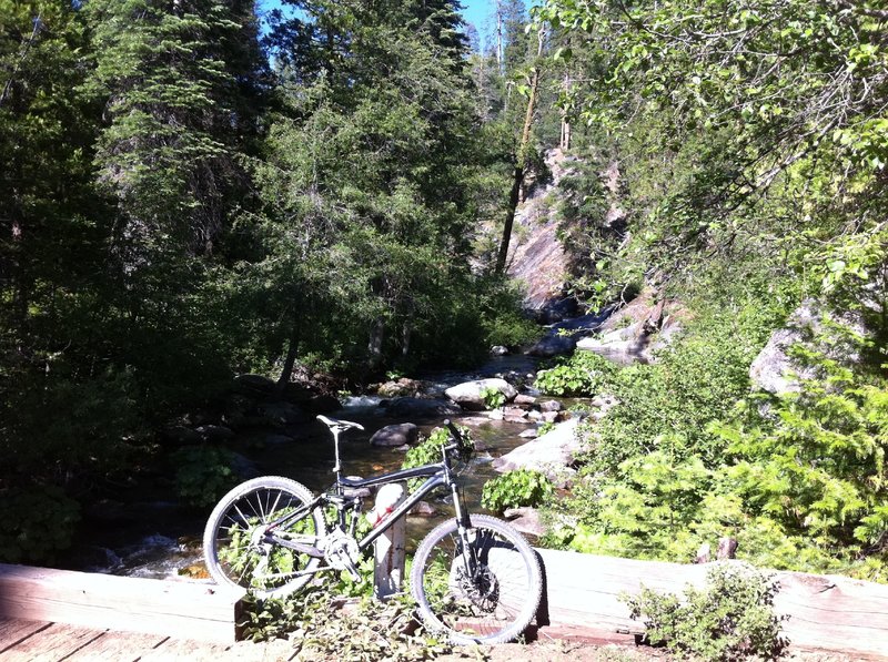
Wooden Bridge crossing Beaver Creek
Wooden Bridge crossing Beaver Creek
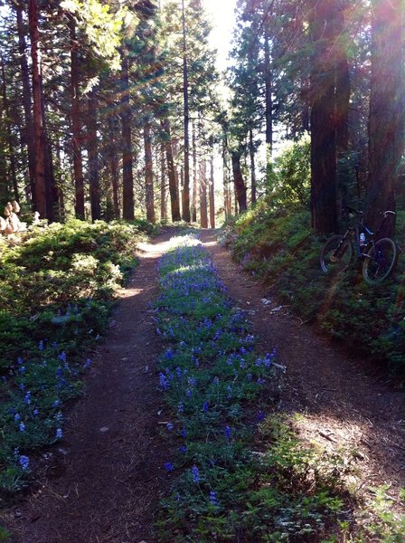
Late June to mid-July are usually the best days for wildflowers on the trail.
Late June to mid-July are usually the best days for wildflowers on the trail.