1.1 hr
Overview
This new (as of April 2018) trail starts 1.7 miles up FS Road 2060 from the top of Lithia Park on the west side of the Ashland watershed and connects to the Fell on Knee Trail at the spectacular "lunch rocks". <br><br>Designed to be one of the least steep trails in the lower watershed, it still climbs a net 650 ft. over a bit over 1.5 miles. After a few early switchbacks, you'll begin to see an expansive view of the Ashland watershed with views of Mt. Ashland. Around the one-mile mark, you'll start to see views of Ashland and Mt McLoughlin. There is a considerable flat area just around the 1-mile mark that is suitable for a mid-ride snack. <br><br>Shortly thereafter, you may notice the trail passes through a fallen sugar pine that dates before Oregon became a state. The trail ends at the Fell on Knee Trail at what have become known as the "lunch rocks"\u2014a granite boulder outcropping with a stunning view of Mt. Ashland and the heart of the Ashland watershed. Wildflowers abound at the lunch rocks in mid-May through early June.<br><br>Various loops are possible. A 7-mile loop starts from Lithia Park, heading up the west-side of FS Road 2060 to Wonder, climbing Wonder, and then turning right on Fell on Knee Trail down to Hitt Road (FS Road-300). Turn right there and head either down to Strawberry Lane (turn right) back to Lithia Park, or from the beginning of the paved part of Hitt Rd, turn right onto an un-named trail that drops to the Ashland Canal Trail (aka TID trail). You can then to Lithia Park via the Granite St Trail.
Trail Stats
2.4 km
231 m
1072 m
891 m
—
Photos
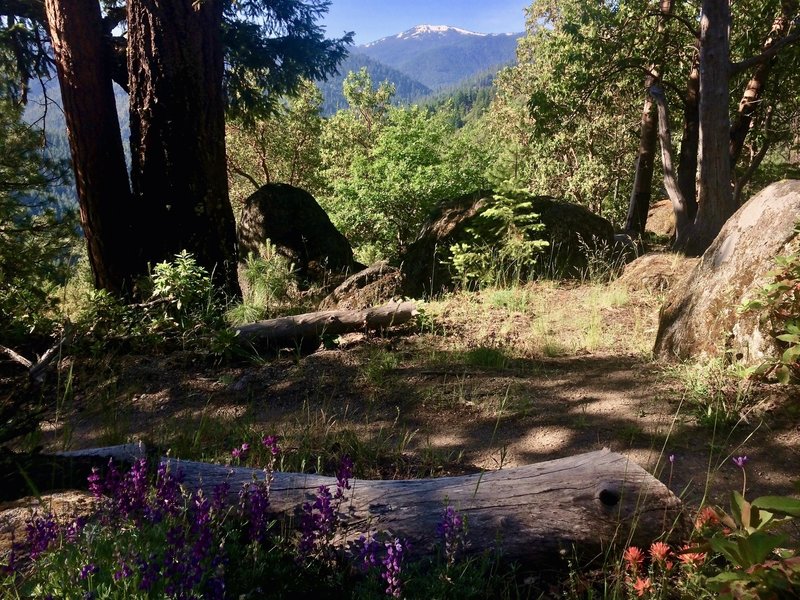
View from Fell on Knee
View from Fell on Knee