4.1 hr
Overview
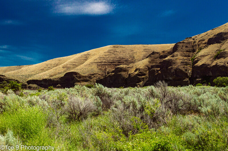
Pinnacles Trail is a 9.6 mile lightly trafficked out and back trail located within Cottonwood Canyon State Park that runs along the John Day River, a designated Wild & Scenic corridor. The trail is primarily used for hiking, walking, and mountain biking and is accessible year-round. Dogs are also able to use this trail but must be kept on leash. Trail starts at N end of the Campground area within Cottonwood Canyon State Park, runs parallel to the John Day River, heading downstream. It is an old road, mostly gravel/dirt, bit there are some very rocky sections right near the start where the trail passes directly under some large cliffs, you'll want to have some sort of shocks to absorb the bumps as there is a talus roadbed for perhaps a mile of so.. Spectacular views on both sides of the river of towering cliffs. At 1.35 miles, the trial intersects with the Walnut Trail, a single tack that runs both above (Upper Walnut) and below (Lower Walnut). In another 0.4 mi the trail intersects with Lower Walnut Trail and another 0.25 mile brings you to the other end of Upper Walnut Trail. At 1.8 miles from start, the trail runs right above the river Continuing to a bend to the N at 2.81 Miles. Not long after, at about 3.1 miles you reach a gate, where the seasonal closure (Feb - Oct) begins. When the trail IS open beyond this, it goes thru a sandy stretch for approx. a mile before coming up to the face of a large cliff on the L. AT this pot the rail be comes a rocky singletrack, much more challenging, I would rate as intermediate, which can be somewhat overgrown. In about another 0.8 miles the trail peters out, or at least it was so overgrown making finding route difficult. This is where the official trail ends, you may be able to go further depending on your skill and determination. Eventually you would leave the park and enter The BLM Central Oregon - Prineville Field Station area at approximately 6 miles from the trailhead.
Trail Stats
16.0 km
48 m
169 m
153 m
—
Photos
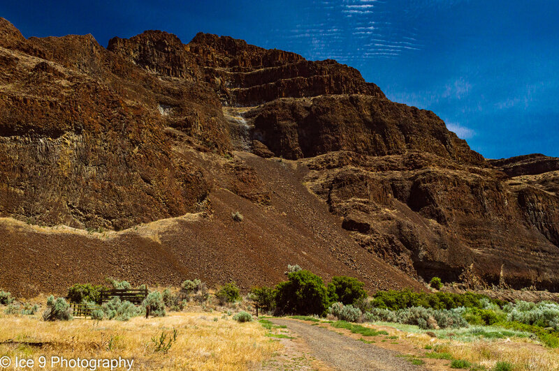
Towering Cliffs above the begging of the trail.
Towering Cliffs above the begging of the trail.
Looking downstream near the start of the Pinnacles Trail.
Looking downstream near the start of the Pinnacles Trail.
Looking back upstream to the Lone Fir Campground at Cottonwood Canyon State Park, from the beginning of the Pinnacles Trail
Looking back upstream to the Lone Fir Campground at Cottonwood Canyon State Park, from the beginning of the Pinnacles Trail
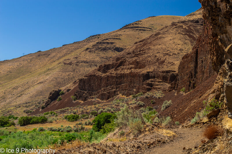
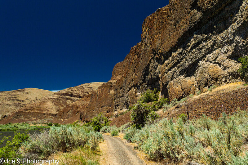
Below the Cliffs on Mile 1 of the Pinnacles Trail.
Below the Cliffs on Mile 1 of the Pinnacles Trail.
Return view of the last segment (or 1st if you've just started) just before the trailhead.
Return view of the last segment (or 1st if you've just started) just before the trailhead.
The return view of the trail beneath The Cliffs at the start, it's a talus surface underneath them.
The return view of the trail beneath The Cliffs at the start, it's a talus surface underneath them.
Pinnacle Trail, looking back upstream towards trailhead.
Pinnacle Trail, looking back upstream towards trailhead.
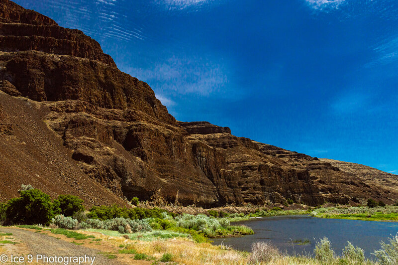
Looking NE from The Pinnacles Trail at the cliffs above the opposite shore of the John Day River.
Looking NE from The Pinnacles Trail at the cliffs above the opposite shore of the John Day River.
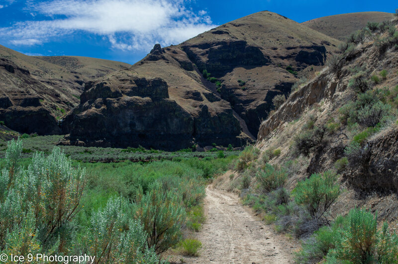
Looking back at the first mile of the Pinnacles Trail.
Looking back at the first mile of the Pinnacles Trail.
The Pinnacles trail, looking back across the River to the Lost Corral/Esau Canyon area.
The Pinnacles trail, looking back across the River to the Lost Corral/Esau Canyon area.
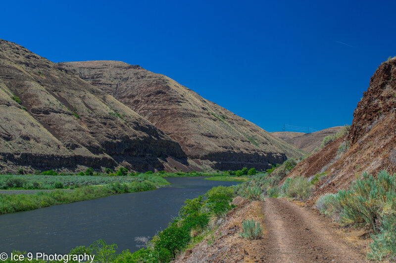
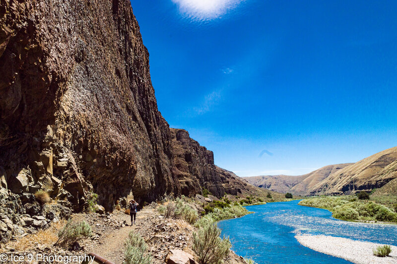
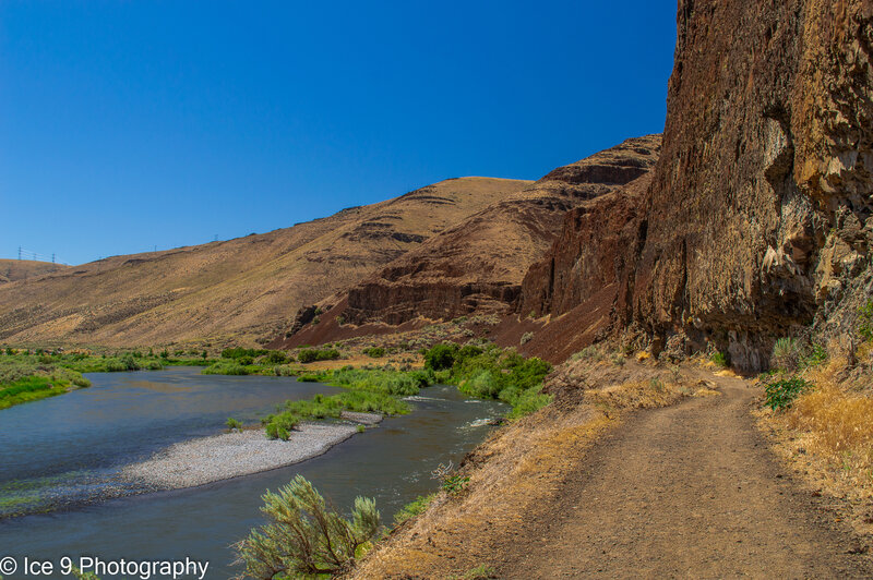
The trail runs right above the river in this section.
The trail runs right above the river in this section.
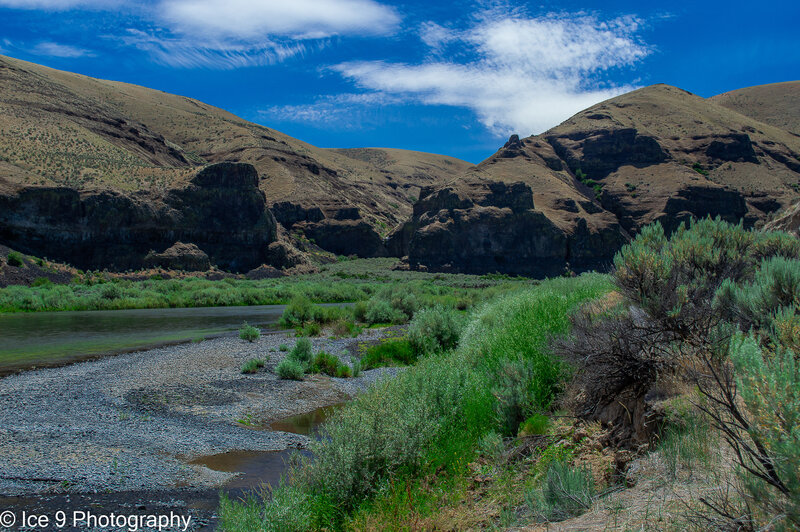
Looking across the river from the trail at the mouth of Esau Canyon.
Looking across the river from the trail at the mouth of Esau Canyon.
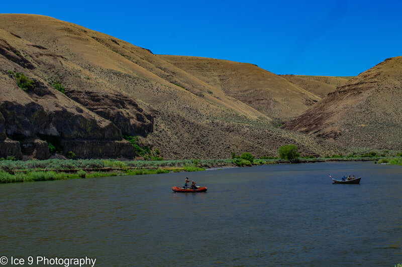
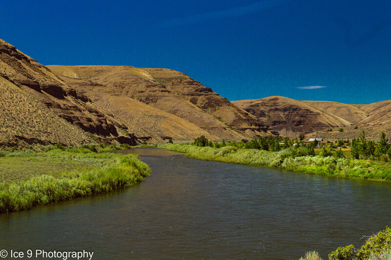
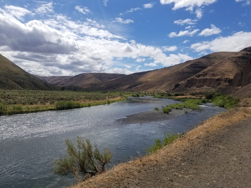
The John Day River, which the tail runs along, is one of the premier overnight rafting destinations in OR. You frequently will see them floating by!
The John Day River, which the tail runs along, is one of the premier overnight rafting destinations in OR. You frequently will see them floating by!