3.4 hr
Overview
Ride this trail in either direction. Make a loop by utilizing the paved Applegate road, or Da-Ku-Be-Te-De. <br>As described, you'll encounter a shorter, steeper climb combined with a longer descent. Ridden south to north, expect a longer gentler ascent with shorter steeper descent.<br><br>From the trailhead across the road from Hart-tish picnic and boat launch area, the trail drops down to beautiful, shaded Grouse Creek, making a couple crossings as it follows it upstream. <br><br>A short detour can be made about .75 miles up the trail to an abandoned miner's cabin and inactive Bigfoot trap.<br><br>Leaving the creek, the trail climbs steeply, gaining 1,000 feet in elevation. <br>From the ridgetop, a short descent is followed by a traverse along the west side and another short climb to the high point which is just SW of the summit of Collings Mountain. <br>Along the way, excellent panoramic views of the Applegate Lake and the Siskiyou Crest abound.<br><br>From the high point, descend steadily for 3 miles to Watkins Campground. The last 0.5 mile of trail passes through the 62 acre Watkins fire that burned in 1981.
Trail Stats
10.0 km
557 m
1064 m
613 m
—
Photos
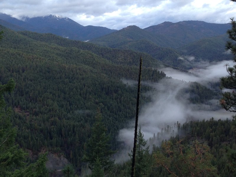
View Northwest from Collings Mountain
View Northwest from Collings Mountain