5.3 hr
Overview
Go to the intersection with Rendezvous Basin Road, above Edelweiss, after driving up East Fawn Creek Road, passing through an open steel gate. You'll park immediately to the left, but note that the trail starts up immediately on the right side of the intersection. From Goat Creek Road to the trailhead is 1.7 miles.<br><br>To begin this ride, start on the right, opposite from the trail finish, at the entry sign into singletrack marked Start Me Up, an arrow, and a Rendezvous Basin Loop sign. After a switchback climb, follow the singletrack to the right. Follow this section as it curves around the south side of the hill, with great views from a couple of open overlooks. Turn right at a junction and follow the obvious trail. It will curve around a big down tree and over three small creeks on ladder bridges.<br><br>Continue, following the singletrack on the $8 Rake trail. Continue following singletrack, well into the Grizzly Mtn area. Cross a dirt doubletrack and continue following the trail, signed as Cowtown, on singletrack. This winds around for about another mile, and eventually drops steeply onto a narrow dip, then up and quickly turns right, crosses a dirt road and onto singletrack again onto the Raisin Bran section.<br><br>Exit the singletrack from Raisin Bran onto Gunn Ranch Road and head straight across the road onto more singletrack. In a few yards, look for the wooden sign for Witches Run and follow the signs and markers. <br><br>Follow the trail through dense woods, and following more dense thickets (with a Blair Witch Project feel), you'll reach a clear-cut. Follow the doubletrack along the edge (clear-cut and hillside on your right) and continue about 1\u20442 mile, watching for the points where the trail re-enters the woods on singletrack immediately after a little dip. Continue on singletrack through more open terrain, basically following the broad ridgeline, then dipping sharply to the right and climbing up toward Gardner Hut on more singletrack.<br><br>At Gardner Hut, get back on singletrack on the
Trail Stats
17.8 km
522 m
1251 m
944 m
—
Photos
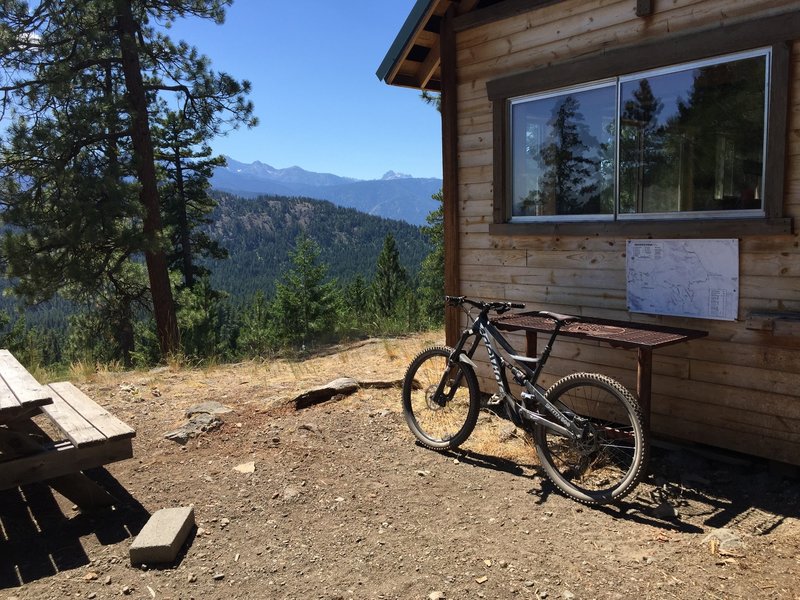
Rest stop at Gardner Hut
Rest stop at Gardner Hut
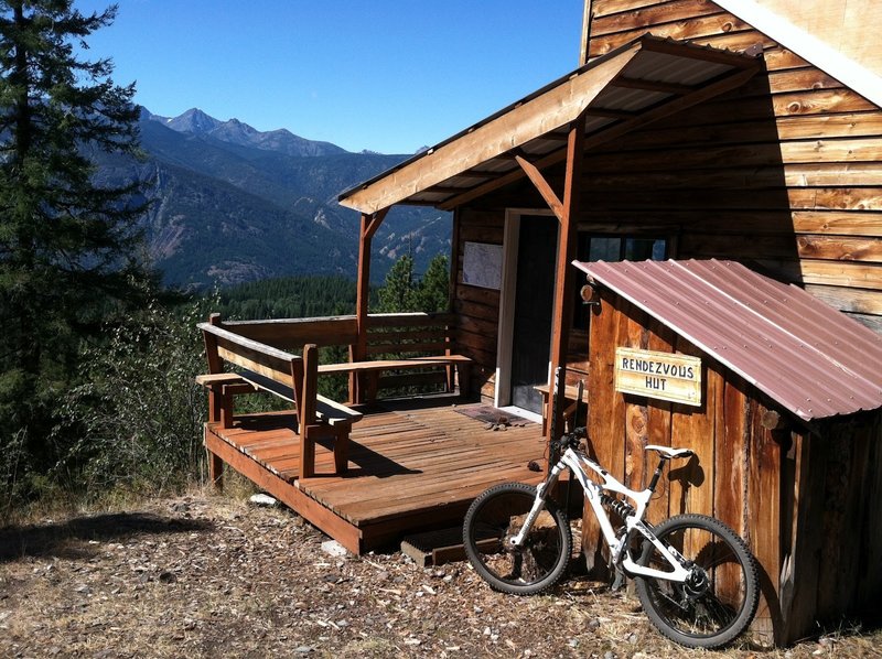
Rendezvous Hut
Rendezvous Hut
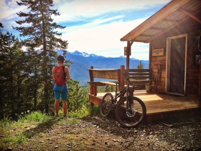
Rendezvous Hut on the Cub Trail.
Rendezvous Hut on the Cub Trail.