3.8 hr
Overview
The trail begins high atop Suntop mountain. The summit is reached from Sun Top Road #7315, but it's also possible to start roughly half-a-mile further down the road or much lower down from the Buck Creek Road #7160. Start at your preferred point by pedaling or taking the easier shuttle option (note that the last bit of road to the summit may be gated off, but there's ample parking nearby). <br><br>After you've enjoyed the views and checked out the lookout tower, it's time to drop in. If you're lucky, the surrounding meadow will be covered in blooms of beargrass. Even if it isn't, the narrow and rough singletrack should keep spirits high, just watch for an awkward rock garden at the start. The descent rushes by as a series of loose rocky straightaways and tight corners, till it ends at the second crossing of the road.<br><br>The next 1.5 miles follows a steady grade through a shady forest. There's nothing technical, but the constant climbing combined with the elevation can make for tough going. Adding to the experience are a number of discouraging false summits. Eventually the grade mellows out at a small opening in the trees, turn right and Rainer comes into view.<br><br>This is a good place to reapply kneepads and such as the rolling terrain ahead has enough gravel to make things interesting. A fun warm-up sections passes quickly before things let loose. Like all of the descents in the area, Suntop features some fast singletrack. They're just astonishingly long and fast here!<br><br>A few stepped logs let you know its time to engage the "grin-mode" as the trail shoots down the slope on a narrow and gravely bench-cut. Work your way through two sharp switchbacks, and it's back to bombing through the close brush. The delicious singletrack that rushes by is an absolute blast! Just watch for a few small chunky spots and close-cut logs that can result in a spectacular lawn dart off the trail.<br><br>The speed eventually abates before a mile of rolling terrain with a few punchy climbs. The next round starts shortly af
Trail Stats
13.3 km
296 m
1652 m
791 m
—
Photos
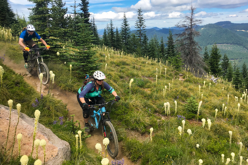
The views at the top of Suntop aren't too shabby.
The views at the top of Suntop aren't too shabby.