7.9 hr
Overview
From Redhook, ride back to the pedestrian bridge over the river and head south along the paved Sammamish River Trail (an extension of the Burke Gilman Trail) towards Redmond. About 3.5 miles from Redhook, look for the high overhead power lines. The Puget Power Trail (PPT) begins under the power lines, just before some apartment buildings. Turn left onto the PPT and climb up to the crossing of Redmond-Woodinville Road. Cross the road and continue climbing. After cresting the hill, the wide gravel PPT crosses several roads. <br><br>After a couple more descents and climbs, the trail descends down to Avondale Road. Use the pedestrian signal and cross to the other side. Parallel a wood fence and then cross over a creek on a bridge. Careful, the dirt road is a driveway so keep an eye out for vehicles. Immediately after crossing the creek, see a sign for the PPT and turn left. Wind through the woods on the wide dirt trail, stay straight at a 4-way trail intersection and take lefts at the next two intersections. The PPT climbs a short hill under the overhead power lines before it comes out on a paved road. Take a left at the road (196th Ave) until it tees into 116th St. Turn right and climb up to a stop sign at Redmond Road. Continue straight at the stop sign and take the next right onto 206th Ave. The road descends and then turns left under the power lines. Take the bark trail straight ahead up "Horse Pasture Hill" and climb towards a fence.<br><br>On the right side of the fence, find a trail that parallels the fence. Climb up and at the sign for the Redmond Watershed vear right onto an established trail. The trail comes back under the power lines where you take a right. Follow under the power lines and after crossing a 4-way intersection look for a short section of trail on the right. The trail crosses under the power lines again and then descends to a bridged creek crossing before climbing again. At the top, take the left trail (the other two lead back towards Novelty Hill Road).<br><br>Stay on the main trail throug
Trail Stats
28.7 km
417 m
167 m
8 m
—
Photos
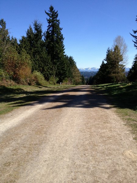
Looking East along the Tolt Pipeline; Cascade Mountains visible in the distance
Looking East along the Tolt Pipeline; Cascade Mountains visible in the distance
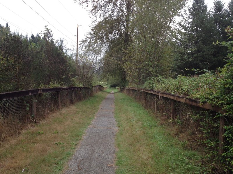
Singletrack connecting Puget Pipeline Trail
Singletrack connecting Puget Pipeline Trail

The Trail inside the Redmond Watershed are 36-48" wide and very well maintained. Very easy and nothing technical at all. It is nice and "flowy" at a quick pace.
The Trail inside the Redmond Watershed are 36-48" wide and very well maintained. Very easy and nothing technical at all. It is nice and "flowy" at a quick pace.
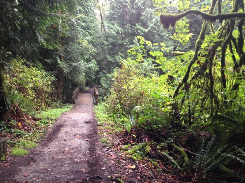
The watershed is filled with deep, lush vegetation and in best conditions after rainfall (or during light rainfall). Take it easy around the several wooden bridges, they can be very slippery for knobby tires.
The watershed is filled with deep, lush vegetation and in best conditions after rainfall (or during light rainfall). Take it easy around the several wooden bridges, they can be very slippery for knobby tires.

After riding 3.5 miles along the paved Sammamish River trail, look for this trail cutoff on your left (next to a Trail Information booth) that will take you up to the Puget Powerline Trail.
After riding 3.5 miles along the paved Sammamish River trail, look for this trail cutoff on your left (next to a Trail Information booth) that will take you up to the Puget Powerline Trail.

Heart Attack Hill ascent - Stinky Spoke 2013 (clockwise)
Heart Attack Hill ascent - Stinky Spoke 2013 (clockwise)
The "Thrilla" markings along the route.
The "Thrilla" markings along the route.