13.7 hr
Overview
Ride on the valley floor from the vicinity of the Robinson Creek or Ballard Forest Service campgrounds. After about a mile, you start climbing. It's not difficult until about mile 4, where you reach a promontory with a view into another valley. At that point, the road becomes rockier and rougher and the grade increases. But it's rideable. A mile or two of hard climbing and it eases off again, allowing one to resume a steady, almost middle-ring climb.<br><br>About mile 11.3, and about 3500 feet above the valley floor, one reaches Harts Pass and an intersection with the Pacific Crest National Scenic Trail (bicycles forbidden under Forest Service policy) and other dirt roads. There's a Forest Service guard station there, with residents in the summer of 2015, and a picnic table.<br><br>So far, the scenery will have been unexceptional, though pleasant. But as you look up the road from Harts Pass toward Slate Peak, you get a glimpse of what's in store. Ascending, the road winds through a landscape that looks like the Swiss Alps. And you start to get better and better views of the Cascades.<br><br>To get to the old military observation site at the top, you go through a gate (motor vehicles must stop at this point) and do a tough final power climb. At the summit, you're standing on Slate Peak, a mesa that the military may have leveled off for their now closed observation tower. There, the views are nothing short of unforgettable. You'll be ringed by jagged peaks, some snow-covered, in every direction except north, where you see a magnificent valley (maybe a cirque) in the Pasayten Wilderness well below you. Don't forget your camera.<br><br>The descent will, naturally, be a blast and you'll be rewarded for all of that climbing.
Trail Stats
44.8 km
1501 m
2252 m
759 m
—
Photos
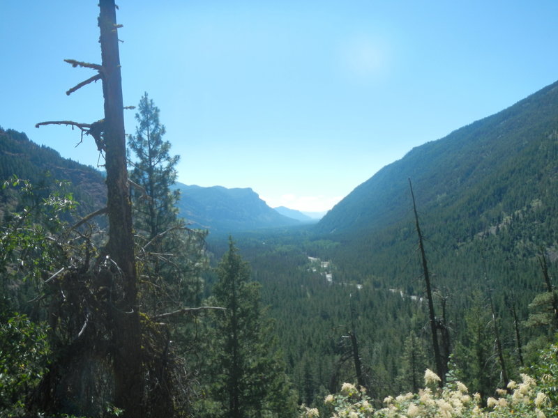
Looking back at the valley floor forward Mazama, near the beginning of the climb.
Looking back at the valley floor forward Mazama, near the beginning of the climb.
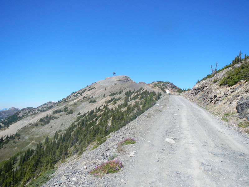
Slate Peak in the distance, with its old military observation tower (no legal access). Note the steep pitch of the final climb, which you can see in the distance.
Slate Peak in the distance, with its old military observation tower (no legal access). Note the steep pitch of the final climb, which you can see in the distance.
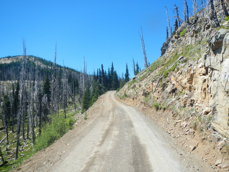
The long climb toward Harts Pass. Don't let the bark beetle infestation deathscape bother you. A Forest Service employee in Colorado told me it's natural and the regrowth there is underway, which I saw for myself.
The long climb toward Harts Pass. Don't let the bark beetle infestation deathscape bother you. A Forest Service employee in Colorado told me it's natural and the regrowth there is underway, which I saw for myself.
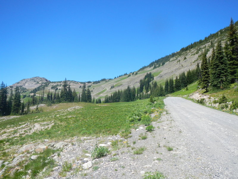
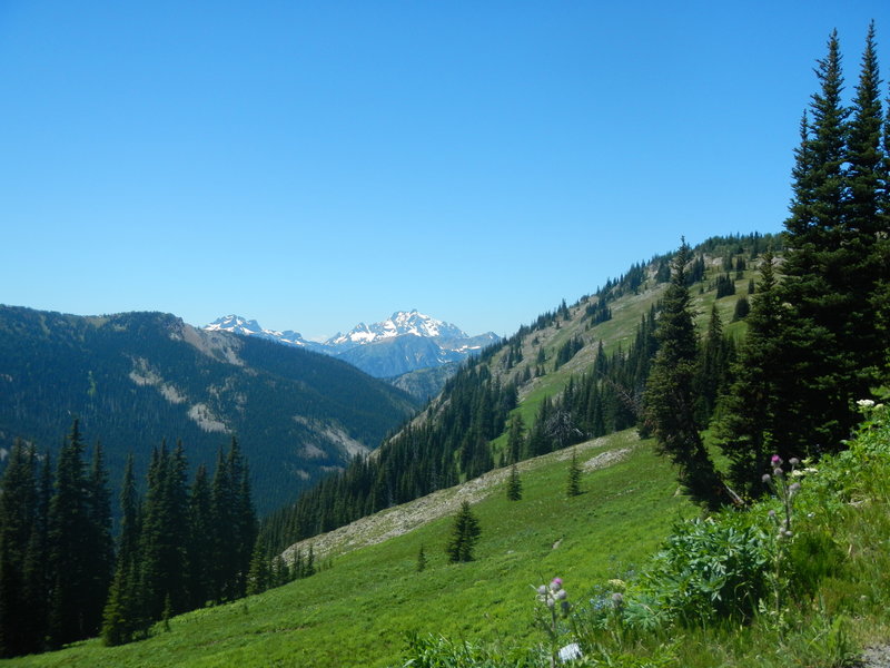
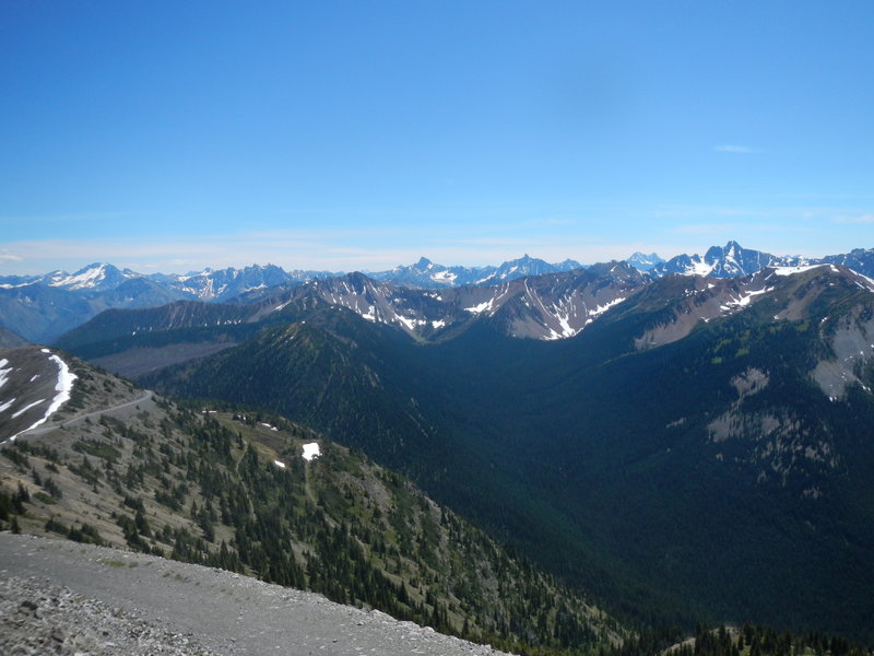
Leaving Harts Pass for Slate Peak, you begin to get a sense of the majesty of this area.
Leaving Harts Pass for Slate Peak, you begin to get a sense of the majesty of this area.
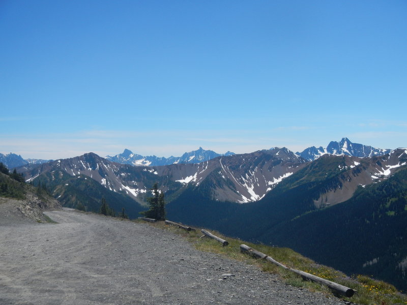
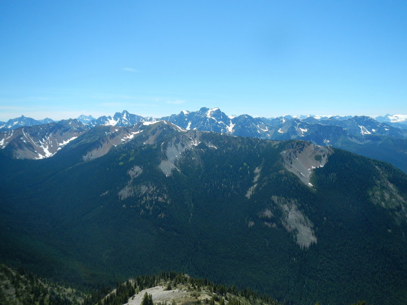
Getting more spectacular by the minute as you climb. But you ain't seen nothin' yet!
Getting more spectacular by the minute as you climb. But you ain't seen nothin' yet!
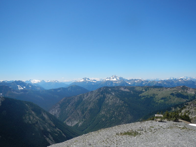
Near the top, you get a sense of what it'll look like from the summit.
Near the top, you get a sense of what it'll look like from the summit.
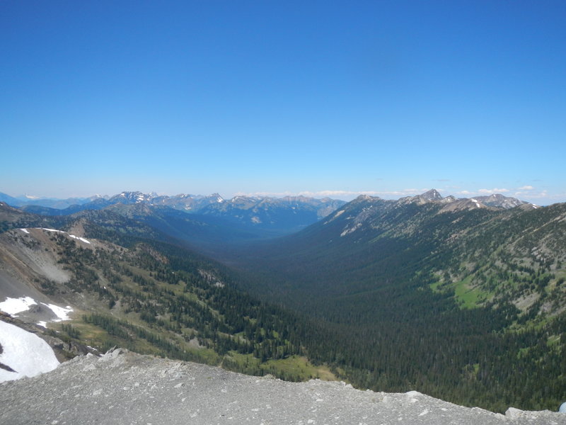
Looking north into the Pasayten Wilderness far below. Not sure if this is a glacial cirque or not. The Canadian border is about 30 miles north.
Looking north into the Pasayten Wilderness far below. Not sure if this is a glacial cirque or not. The Canadian border is about 30 miles north.
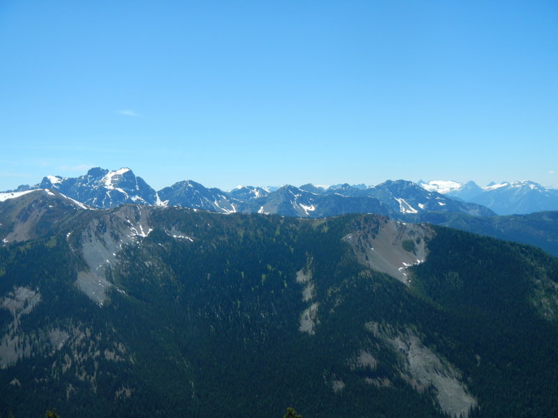
The Cascades at their best.
The Cascades at their best.
Res ipsa loquitur . . . it speaks for itself.
Res ipsa loquitur . . . it speaks for itself.
At the top!
At the top!
Looking back whence you came, i.e., Harts Pass.
Looking back whence you came, i.e., Harts Pass.