4.9 hr
Overview
While it is still basically a Cascades ride, meaning go uphill for a long while and finally have a long descent, there is a bit of downhill on the first half to break it up. The climb is technically easy as it's on a gravel road so you can focus on skill riding for the second half when you are well warmed up. <br><br>Start on gravel Taneum Road #3300 at Taneum Junction campground and the trailhead for Taneum Ridge Trail #1363. Climb from 2800 feet to 3700 feet in about 2.5 miles where the road meets the trail the first time. You can turn east (left) on the trail here for a shorter ride and a bit easier trail. Or continue on Taneum Road #3300 for another 3.0 miles, dropping back down to 3400 feet and then up to 4200 feet. There is very little traffic on this road, but a long grind. <br><br>At the second trail intersection, head east (left). The trail opens to stunning views to the north of the Stuart Range. It climbs and drops like a roller coaster for about a mile and is steep and very rocky. The trail then goes entirely into forest again with a deep groove, banked curves, and steep descent. You'll cross the road you came up on after 3.0 miles. You could choose to take the road back, but the second section of trail is easier (fewer rolling rocks on the path, less mud, better grade, and banked edges). You'll be smiling!
Trail Stats
15.7 km
597 m
1305 m
868 m
—
Photos
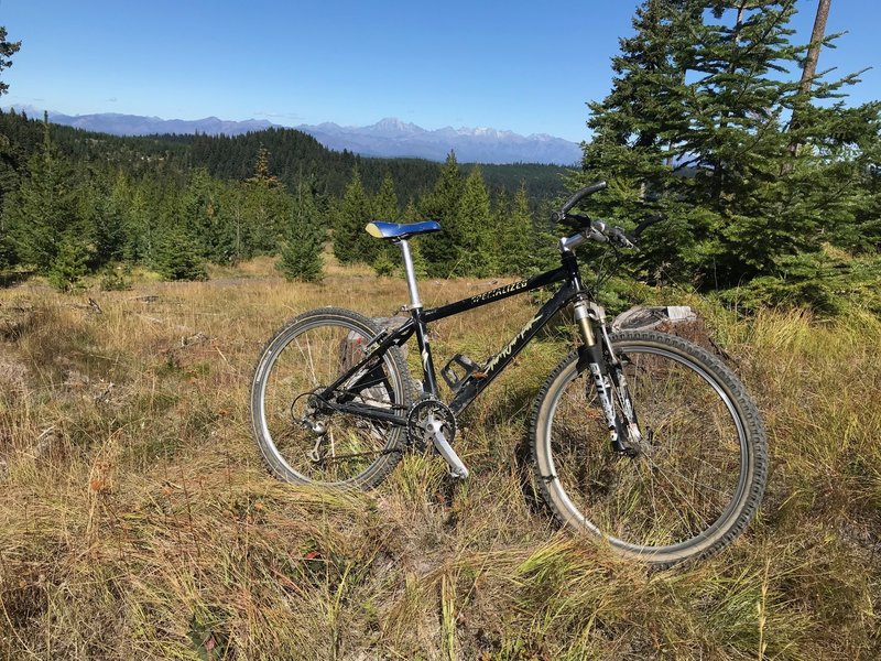
The fleeting view at the top will beg for a pose with your trusty steed.
The fleeting view at the top will beg for a pose with your trusty steed.