1.3 hr
Overview
Starting from the Catherine Creek Parking Lot, this trail begins innocently enough in a large, flat-ish meadow. At the parking lot, the trail immediately forks after crossing the gate. Take the left. Some of the trails to the right are closed to bikes.<br><br>After a while, the trail reaches the Rowland Wall, the little brother of the nearby Coyote Wall. The trail will begin to get extra choppy and rocky, and much steeper. Much of this climb is rather difficult, but it offers beautiful views of the Columbia River.<br><br>Finally, towards the top and after about a mile, the trail will fork. Staying to the left and going down into the oaks will carry you across a stream and back up abruptly to the steep hills westward. After only a quarter mile of this, the trail forks again, with a helpful sign that gives no indication as to which trails you're on. Proceeding forward and up the hill will take you to the doubletrack Atwood Road.<br><br>Taking the left begins the winding descent through Shoestring to Loose Lucy and Hidden Canyon.<br><br>Like all trails in the Coyote Wall/Syncline System, this trail has poor signage and it could be possible to take a wrong turn. Be sure to have a map with you, take a picture of a map at the trailhead if you're using a smart phone, or use the <a href='/mobile-app'>MTB Project mobile app</a>.
Trail Stats
2.7 km
296 m
385 m
89 m
—
Photos
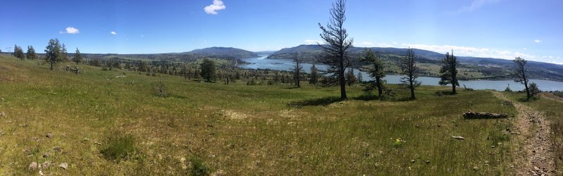
Gorgeous views of the Columbia River climbing up Rowland Wall Trail.
Gorgeous views of the Columbia River climbing up Rowland Wall Trail.
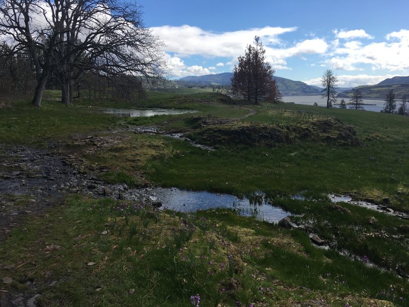
The Rowland Wall Trail is pretty soupy and swampy in late March.
The Rowland Wall Trail is pretty soupy and swampy in late March.
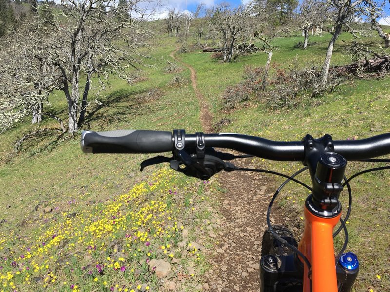
Early spring wildflowers line the singletrack climbing up the Rowland Wall Trail.
Early spring wildflowers line the singletrack climbing up the Rowland Wall Trail.